
Trace Hazlet Streets by Address
A street search in Hazlet Township should begin with the physical parcel, not an assumption about who occupies it. The Monmouth tax system can associate an address with a block and lot, an assessed owner, assessment data, and a mailing address. A deed can then document parties to a transfer, while voter and historical sources may offer separate, time-bound confirmation. Those records answer different questions. An assessed owner or a mailing address can be useful, but neither proves that a person lives at the situs address today.
- Use the Monmouth OPRS tax-list address index with the street name, Hazlet Township, and the needed tax-list year. Save the block, lot, and any qualifier shown with the result.
- Open the Monmouth County GIS Map Viewer, locate the parcel, and compare its shape and neighboring lots. GIS supplies geography, not a legal survey.
- Use the parcel key in the county land-record search. Read the recorded deed for the grantor, grantee, recording date, and legal description.
- For a registration question, use the state voter lookup to verify an individual record, or ask the Monmouth Commissioner of Registration about the statutory election-district list route.
- For an older household question, ask Hazlet Library or the Monmouth County Historical Association whether an address-indexed or reverse directory actually exists for the relevant year.
That sequence keeps the address search tied to the source that produced each fact. It also makes a no-result more useful: the parcel may be in another municipality, under an old name, or outside a portal's online period.
Read Hazlet Street Directory Parcel Cards
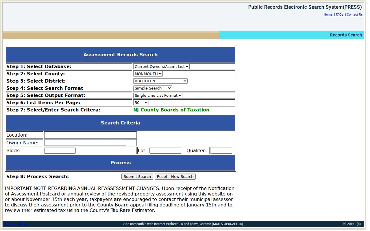
The county's MOD-IV and tax-list tools are the main address layer for a Hazlet parcel search. Address mode is for a road, owner mode is for an assessed owner, and block-and-lot mode is for a parcel already identified from a deed or map. The portal requires a municipality and a tax-list year. Treat those choices as part of the record citation, especially when comparing one address across years.
| Portal field | How it works in Hazlet |
|---|---|
| Street name | Required in Address mode; select Hazlet Township separately. |
| Township | Required for address, owner, block-and-lot, and aggregate modes. |
| Year | Required tax-list year; the live portal controls the available range. |
| Owner name | Required in Owner mode; try the recorded spelling variants shown by the index. |
| Block, lot, qualifier | Block and lot are required in that mode; qualifier is optional for a qualified parcel. |
| Category controls | Exempt, regular, railroad, and telephone choices prevent unlike property types from being grouped together. |
The Monmouth MOD-IV property search is the source shown below. A parcel detail may contain its property location, owner, mailing city and state, block, lot, qualifier, class, year built, zone, acreage, taxes, and tax-list history when those fields are populated. A blank or redacted owner name is not evidence that no owner exists.
The county MOD-IV property-search screen shows the address, owner, and assessment entry point used for Hazlet parcel work.
Use the card as a parcel record, then check its date and the displayed fields before connecting it to a street-level conclusion.
Note: Daniel's Law can redact a covered owner's identifying information while leaving parcel geometry and other nonprotected fields visible.
Match Hazlet Addresses to Parcel Keys
Three address-like fields can point in different directions. Hazlet property work is more reliable when each is kept distinct. The situs is the physical location used by maps, permits, and street browsing. The mailing address is where tax correspondence goes, which can be outside Hazlet. The legal description is the block, lot, qualifier, subdivision reference, or metes-and-bounds language that follows the land through a road-name change or lot split.
- Parcel
- A defined tract in the tax and mapping system, commonly identified in Hazlet by block, lot, and sometimes a qualifier.
- Situs address
- The physical property location. It is the address most useful for a street-by-street map search.
- Plat
- A recorded map that can show how a subdivision or lots were laid out. It is not a substitute for a current legal survey.
- Criss-cross directory
- A reverse directory arranged by address rather than name. Hazlet-specific runs were not verified, so confirm holdings with a reference desk first.
The statewide New Jersey Geographic Information Network parcel guidance notes that parcel polygons are not survey data and that owner names may be redacted. For a disputed boundary or a title question, use the recorded deed, plat, or County Clerk counter rather than the map image alone.
Follow Hazlet Deeds Along Streets
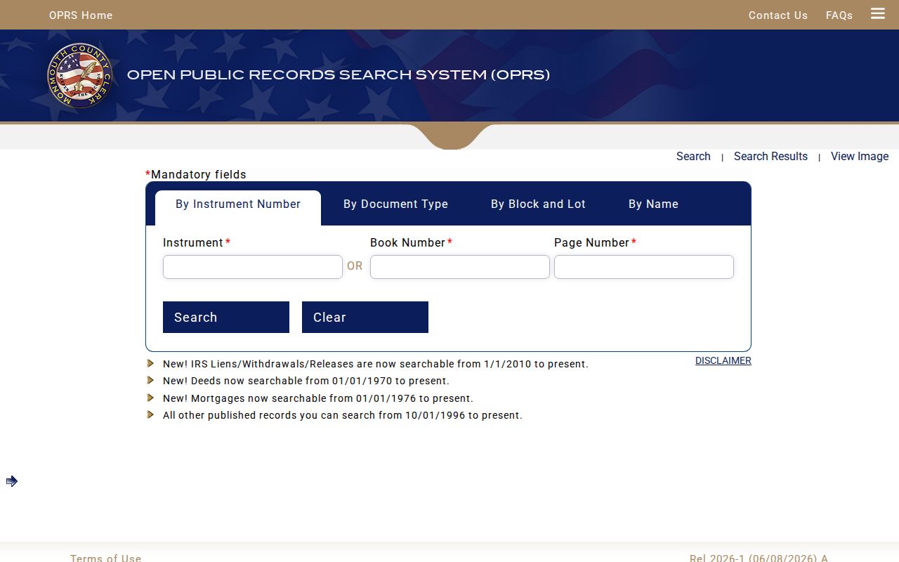
Once the block and lot are known, the Monmouth County Clerk Open Public Records Search System can connect the parcel to recorded instruments. Its online cutoffs are specific: deeds begin January 1, 1970, mortgages January 1, 1976, IRS liens and related releases January 1, 2010, and other published records October 1, 1996. The index is free to inspect, but the county says the online material is informational, document images are not certified copies, and formal title work belongs at the Freehold counter.
Search block and lot or select Hazlet Township and a document type, then compare the legal description with the parcel card. A deed normally names the grantor, the seller, and the grantee, the buyer. To move back in time, search the seller as an earlier buyer for the same legal description. A grantor is the party conveying an interest; a grantee is the party receiving it. Both can have transaction addresses that are not current residences.
The official OPRS land-record screen shows the instrument, document-type, block-and-lot, and name paths used to begin a Hazlet deed search.
Break a long OPRS date search into rolling windows because the portal limits a date range to 90 days.
Map a Hazlet Street by Parcels
Monmouth GIS is useful for seeing the physical order of lots along a road. Search or pan to the target street, identify the parcel, note the PIN or block-and-lot value, and then inspect polygons beside it or across the road. The viewer and GeoHub include parcel layers, aerial imagery, zoning, flood and hazard context, municipal boundaries, roads, districts, and planning layers. Record the layer name and data date when the layer matters.
A visual neighbor is not automatically a single contiguous household. A right-of-way, public road, irregular lot, condominium arrangement, or easement can interrupt what looks like one block. Use GIS to establish location, MOD-IV to read the assessment data, OPRS to inspect the recorded instrument, and Hazlet's permit route for construction history. This division of labor limits false joins in an address chain.
Check Hazlet Permits by Street
Hazlet's SDL permit portal is another address-based source. The township says a free account is required, the public search can use street, address, or block and lot, and digitized property information begins in 2012. For a record before that cutoff, send a focused OPRA request to the Municipal Clerk rather than assuming the absence of a portal hit means no permit exists.
A useful request names the address, block and lot, date span, and record type. Ask for existing permit applications, approvals, inspection reports, notices, certificates, and closure dates. Code Enforcement and Zoning do not have a public case index documented in the research, so an address-specific OPRA request is the documented fallback. The response can contain redactions for protected information.
Note: Include the property key and the date range so the Hazlet custodian can identify existing records without creating a new report.
Hazlet Street Directory Record Coverage
Address-keyed records overlap, but they are not interchangeable. The following routes preserve the distinction between assessed ownership, recorded transfers, street geography, and historical occupant clues. They also show the alternate access channel when an online result does not reach far enough.
| Address record | Custodian | Street-level value | Access route |
|---|---|---|---|
| MOD-IV and tax list | Monmouth Board of Taxation and Hazlet Assessor | Assessed owner, situs, mailing field, assessment, class, and annual tax-list history | Free OPRS portal; assessor counter or phone |
| Tax map and GIS parcels | Hazlet and Monmouth County | Parcel geometry, block/lot, adjoining lots, and map layers | Tax-map link and free GIS viewer |
| Deeds, mortgages, plats | Monmouth County Clerk | Parties, recorded dates, legal description, book/page, and instrument image | OPRS within online cutoffs; Freehold counter for older or certified work |
| Permits and code material | Hazlet Construction, Code Enforcement, and Zoning | Property work, dates, applications, and related existing files | SDL from 2012; targeted OPRA for older or unposted records |
| Historical address sources | Hazlet Library and MCHA | Possible address-to-occupant, occupation, or household clues | Reference inquiry; exact Hazlet reverse runs remain unverified |
For older deeds, the County Clerk books and the New Jersey State Archives are the next steps after the online cutoff. Hazlet municipal materials from 1901 through 1998 are held at Monmouth County Archives while Hazlet retains ownership. Each route has a different index and date range.
Bridge Hazlet's Earlier Street Names
Historical address work needs a municipal name as well as a street name. Hazlet was created from Middletown as Raritan Township in 1848, then renamed Hazlet Township in 1967. A property or family record from the earlier period may therefore be indexed under Middletown or Raritan Township instead of Hazlet. Search the historical municipality that matches the year and keep the original index term in the notes.
The Aumack cemetery history supplies a concrete road-name clue: Lynn Boulevard was formerly the one-lane dirt road Aumack Lane, and the former farmland became Raritan Ridge Estates. That does not create a general rename table. No official township-wide street-renumbering or full renaming list was found. Match an older description through its legal description and a dated map rather than silently converting it into a current street number.
Use Hazlet Voter Records Carefully
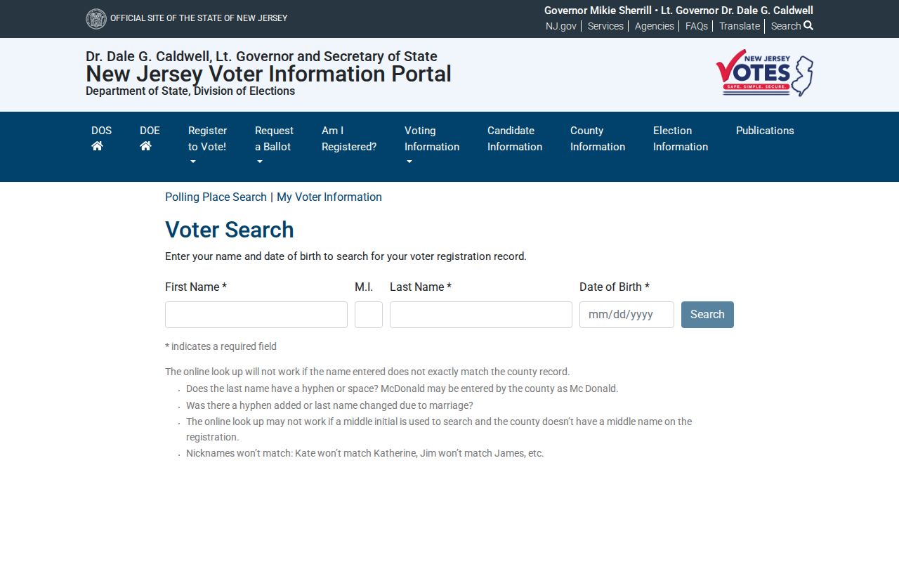
New Jersey's Am I Registered? voter search is designed to confirm an individual registration record, not to browse an entire street. The official guidance says matching is sensitive to the county spelling of a name. Try hyphens versus spaces, married-name changes, middle initials, and a full given name rather than a nickname. City, county, and date-of-birth information help distinguish the right record.
For an election-district or municipality-wide list, N.J.S.A. 19:31-39 provides a separate route through the Monmouth Commissioner of Registration. The statute allows a computer-generated or electronic voter list at uniform reproduction cost, not over $375, but excludes signatures, Social Security numbers, driver-license numbers, and covered-person addresses. Participation history does not reveal a ballot choice.
The New Jersey voter lookup is the official individual-registration interface used for a careful name confirmation.
Use a voter match as a dated registration clue, then compare it with the parcel and deed record instead of calling it proof of current occupancy.
Limit a Hazlet Street Directory Search
A Hazlet street directory cannot supply a complete household list. People without a recorded ownership role are not listed in a property owner roll. Utility, delivery, and customer records are not an ordinary public street directory, and motor-vehicle address data is protected. Voter records also withhold sensitive fields. New Jersey's Address Confidentiality Program and Daniel's Law can limit exposed addresses or owner names for protected people.
Lawful use. Use Hazlet address records for a personal, lawful purpose and respect redactions. Repeated conduct that stalks, harasses, threatens, or intimidates a person can violate New Jersey law.
When the record does not answer the question, ask the named custodian about the proper channel instead of trying to reconstruct protected details from unrelated data. For a past address-to-household question, the Hazlet city directories collection route is the appropriate historical escalation when a verified volume is available.